Gatineau sits on the Ottawa-Bonnechere Graben, a rift valley that creates complex groundwater flow patterns. Over 280,000 residents depend on a road network that crosses sensitive clay deposits and fractured bedrock. Managing surface and subsurface water is critical. Our geotechnical road drainage analysis identifies infiltration zones, perched water tables, and subsurface flow paths. We use in-situ permeability tests and piezometric monitoring to design effective drainage systems. For deeper investigations, we integrate resistivity electrical surveys to map groundwater without drilling, and infiltration testing to measure soil absorption rates directly at the site.
One unaccounted clay lens can divert groundwater under a road base, causing differential settlement within two freeze-thaw cycles.
Scope of work in Gatineau
- Hydraulic conductivity (k) in m/s for each stratum
- Seasonal water table fluctuation records
- Soil gradation curves from sieve and hydrometer analysis
- Compaction control via ensayo Proctor to verify layer density
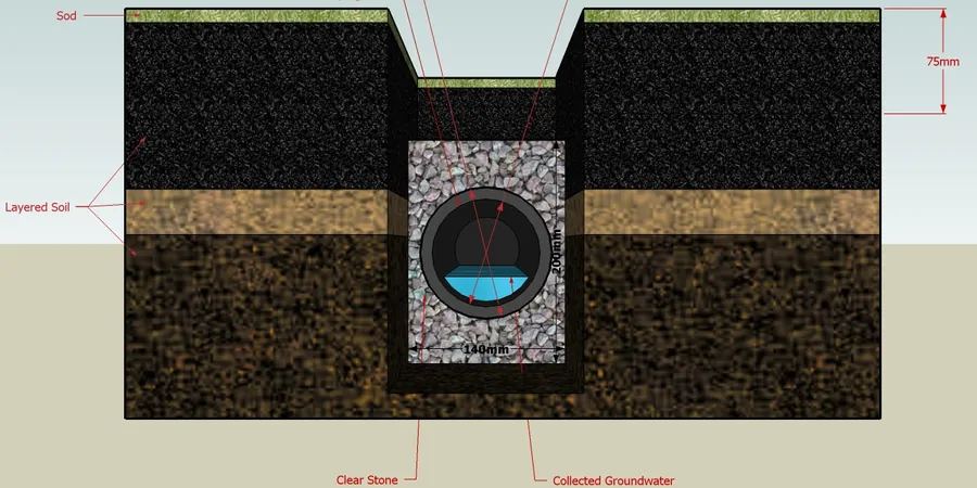
Typical technical challenges in Gatineau
Gatineau expanded rapidly from the 1960s, pushing roads onto former wetlands and agricultural clay flats. Many subdivisions lack adequate subdrainage because original designs assumed natural infiltration. The result: frost heave, pavement breakup, and slope failures along boulevards. Each spring, meltwater saturates the active layer above the frost line. Without geotechnical road drainage, that water has nowhere to go. It builds pore pressure, reduces shear strength, and accelerates road deterioration. A targeted drainage study identifies where to install trench drains, geocomposite strips, or daylight pipes before damage becomes structural.
Our services
We provide four specialized geotechnical road drainage services in Gatineau, each tailored to local soil and climate conditions.
Subsurface Drain Investigation
Installation of standpipe and vibrating wire piezometers to monitor seasonal water table fluctuations. Data collection over wet and dry periods to define worst-case saturation levels for drain design.
Permeability Profiling
In-situ falling-head tests in boreholes and test pits. We measure hydraulic conductivity at each soil layer to identify where water accumulates and where drains must be placed.
Drain System Design Review
Review of existing or proposed drainage layouts using measured soil properties. We calculate required drain spacing, pipe diameter, and filter gradation per FHWA and ASTM criteria.
Long-Term Performance Monitoring
Seasonal follow-up with automated data loggers and manual readings. We track water levels and outflow rates to confirm the drainage system works after construction.
Frequently asked questions
How does Gatineau's clay soil affect road drainage design?
Leda clay, common in Gatineau, has very low hydraulic conductivity (10⁻⁹ m/s) but high shrink-swell potential. Water trapped beneath roads in these clays causes frost heave and pavement cracking. Drainage design must include filter layers that prevent clay migration into the aggregate.
What is the typical cost range for a geotechnical road drainage study in Gatineau?
The typical cost ranges from CA$990 to CA$3,070 depending on site access, number of boreholes, and monitoring duration. A basic study with two piezometers and three permeability tests falls at the lower end; a full seasonal monitoring program reaches the upper range.
When is the best time to conduct drainage testing in Gatineau?
Late spring (April to June) after snowmelt gives the highest water table and worst-case conditions. Testing in winter is possible with frost-resistant equipment, but spring data is preferred for drain design because it captures peak saturation.
What standards apply to road drainage design in Quebec?
The Quebec Ministry of Transport (MTQ) follows the FHWA subsurface drainage guide (NHI-05-037) and CSA A23.3 for concrete drain structures. ASTM D2434 and D5084 govern permeability testing. We also reference the MTQ's 'Chapitre 8 - Drainage' of the Pavement Design Manual.