A commercial development on Boulevard de la Carrière required a clear picture of bedrock depth before foundation design. We deployed electrical resistivity tomography (ERT) and vertical electrical sounding (VES) across the 2-hectare site, running 4 Wenner-Schlumberger arrays to 80 meters depth. The data revealed a buried valley filled with glaciofluvial sands overlying the Precambrian gneiss, a common feature in Gatineau's Laurentian foothills. This allowed the structural team to avoid costly rock excavation by adjusting pile lengths. The resistivity profiles also pinpointed a shallow aquifer near Rivière Gatineau, which we later confirmed with infiltration testing for stormwater management design. The client saved roughly three weeks of drilling by using surface geophysics as the primary investigation tool before any boreholes were placed.
Resistivity surveys in Gatineau routinely map the bedrock interface within ±15 cm when calibrated to one verification borehole per four hectares.
Scope of work in Gatineau
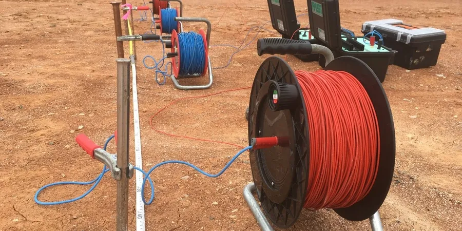
- Array selection: Schlumberger for deep targets (up to 100 m), dipole-dipole for lateral resolution near utility corridors.
- Data inversion: We use smoothness-constrained least-squares models, calibrating against known boreholes from the City of Gatineau geodatabase.
- Depth calibration: At least one verification borehole per 4 hectares ties resistivity layers to actual soil units.
Typical technical challenges in Gatineau
The difference between the Aylmer sector and the Plateau sector in Gatineau is striking. Aylmer sits on thicker post-glacial deposits — clay and silt layers up to 25 m — while the Plateau has shallow bedrock with less than 5 m of overburden. Misinterpreting a low-resistivity clay layer as a water table in Aylmer could lead to an improperly designed drainage system, risking frost heave on shallow footings. Conversely, in the Plateau, ignoring a high-resistivity air-filled cavity in the gneiss (detectable as a sharp anomaly above 2000 Ω·m) might result in unexpected rock fall during excavation. A VES survey with at least one borehole per sector mitigates these risks by providing a calibrated resistivity model before any foundation layout is finalized.
Our services
Our electrical resistivity services in Gatineau cover three main applications tailored to local geology and municipal permitting requirements.
Vertical Electrical Sounding (VES)
Used for depth-to-bedrock mapping and aquifer delineation in the Plateau and Hull sectors. We deploy up to 100 m half-spacing with a Schlumberger array, producing a 1D resistivity profile that identifies the top of the Precambrian gneiss. Typical turnaround is 5 business days including inversion and a detailed cross-section report.
2D Electrical Resistivity Tomography (ERT)
Applied to lateral variability problems such as buried utility corridors, old landfill boundaries, or gyttja pockets in the Aylmer sector. We use 64 electrodes with 5 m spacing, covering 315 m of continuous profile per setup. Data is inverted into 2D sections that distinguish sand, clay, till, and bedrock zones.
Time-Lapse Resistivity Monitoring
For sites with active groundwater extraction or dewatering during excavation. We install permanent electrode arrays and measure resistivity changes weekly, detecting preferential flow paths or moisture migration. This service is used by Gatineau's municipal infrastructure department for cut-and-cover tunnel projects.
Frequently asked questions
What is the difference between VES and ERT for a typical Gatineau residential lot?
VES gives a single 1D resistivity profile directly below the center of the array, ideal for depth-to-bedrock estimation on a 0.5-hectare lot. ERT produces a 2D cross-section showing lateral changes, which is better when the bedrock surface is irregular — common in Gatineau's Laurentian terrain. For a standard house foundation, VES with one calibration borehole is usually sufficient.
How much does an electrical resistivity survey cost in Gatineau?
For a typical 200-meter profile with VES or 2D ERT, the cost ranges from CA$930 to CA$1,350 including mobilization, data acquisition, inversion, and a report with interpreted cross-sections. Additional borehole calibration adds CA$200–CA$400 per borehole. Volume discounts apply for multiple profiles on the same site.
Can resistivity testing detect contaminated soil or groundwater in Gatineau?
Resistivity can indicate zones of elevated conductivity that may correlate with contaminated groundwater (e.g., chlorides, hydrocarbons), but it is not a definitive contamination test. Low-resistivity anomalies (below 30 Ω·m) in Gatineau's clay deposits often reflect natural salinity from the Champlain Sea, not necessarily contamination. We always recommend follow-up soil sampling and laboratory analysis for Phase II ESAs.